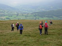
The Leaders Page: advice and useful links for leading walks for the club.
The Cheltenham Rambling Club uses voluntary leaders and are keen to encourage members to come forward to supply walks for the programme. A new leader offering one walk a year helps spread the load across the club programme and avoids relying excessively on a few regulars to come up with the walks. Additionally, new leaders bring forward new ideas and can sometimes offer new perspectives on areas which have been walked before.
Committee members and other experienced leaders in the club are happy to provide advice and support for proposed walk overs. The club also occasionally runs map-reading courses to help potential leaders become more confident in navigating footpaths or finding their bearings on open ground.
The following documents are useful for leaders. The Guidance for walk leaders provides some useful leader information based on the experience of a Cheltenham Club leader. There is also a document giving health and safety recommendations and a form for claiming walkover expenses.
Guidance for Walk Leaders.pdf
Adobe Acrobat document [92.1 KB]
Health and Safety Guidance June_24.pdf
Adobe Acrobat document [87.9 KB]
Walk ideas
The following linked website www.walkinginengland.co.uk/glos has numerous ideas for walks in Gloucestershire. Note: If you decide to use the information in the various downloadable documents to lead a walk; it is important to do a walk-over to ensure the details are still current, before placing a walk in the club programme.
INTERNATIONAL EMERGENCY MOBILE TELEPHONE NUMBER
The following link is a short video giving advice on using the international mobile phone emergency number 112 instead of 999. It may be the case that the 999 number is not programmed into the
software of all mobiles in the same way as 112 is. 112 overrides everything to contact the emergency services using all available networks. The video also tells you how to register for their text
service, which is very easy: "Help Me" The Secrets of using 112 on a mobile phone in an emergency/accident Every rambler should be aware of
the procedure explained in the video.
Additional information
Some walk leaders might like to make a note of the following URL link:
https://www.freemaptools.com/convert-ngr-to-postcode.htm
This tool converts any OS grid reference into a postcode. This might be useful to add to a programme description of a ramble to aid drivers who use satnavs to find the starting point of your walk. Just a suggestion. Note that rural postcodes may not be accurate but can at least get you nearby.
Des F.


